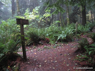
This is a great hike to see the Fall color on Cougar Mountain or during the summer it provides for a cool early morning workout. Like other hikes on Cougar Mtn, the trails are in very good shape and well-marked. This hike is a slightly longer version of this basic loop hike.
The Wilderness Creek trail starts from the trailhead off SR900 between Renton and Issaquah. There are about 15 parking spots on the paved parking lot - which also includes a "Honey Bucket" restroom. There is no running water.
The uphill starts right after crossing the Wilderness Creek - its a good 1.5 miles of moderate uphill gaining about 1,000 feet in elevation to Shy Bear pass.

As you get close to the Shy Bear Pass there is a newly rebuilt wooden foot path crossing one of the many marsh areas at the top of Cougar Mountain. Many thanks to those that did this work, the previous well used foot path was literately falling apart on my last pass through this area.

After reaching the next intersection at Shy Bear Pass, turn left on the Long View Peak trail. This is a less traveled route in the area, so the trail is a bit more narrow -- but is well packed dirt and is in great condition.
 At the intersection with the Ring Road trail (S5), stay to the right to continue on the Long View Peak trail. This part of the hike is fairly level with just small ups and downs.
I usually see a number of big slugs on wet days on in this area, but I did find on Snail taking its time crossing the trail.
 After the recent rainstorm, the trail was almost totally covered with pine needles and big leaf maple leaves in places.
 The trail to -the- Long View Peak view point will appear off to the left.
The view can be good on a clear day, but today it was all clouds. After taking in the view, turn-around and head back toward Shy Bear Pass.

To get back to the Trailhead, you can take either the Wilderness Creek Trail or take the uphill and longer Wilderness Peak/Cliffs route. Both routes end-up near the upper bridge on the Wilderness Creek trail. For a nice workout, take the Wilderness Peak/Cliffs route.
After passing through Shy Bear Pass again, you start a moderate uphill on the Wilderness Peak Trail -- about 200 feet elevation gain to Wilderness Peak. More recent trail work has helped to keep the trail in great shape.
 After about 0.4 miles, you will reach the intersection with the Wilderness Peak and Cliffs trail. There is no view at Wilderness Peak, but its a nice side trip if you want to check it out.
 The Wilderness Cliffs trail then continues off to the right for a great 1.2 miles of true Northwest hiking. There is a small pond, great huge trees, plus a bonus view of Mt Rainier (if clear) on this trail. Note - most folks go Uphill on this trail.
 Like the others this trail is well maintained and in very good shape. At about 900 feet elevation, you will meet up with the Squak Mountain Connector trail (E11). Keep to the right to then meet up with the Wilderness Creek trail back to the Trailhead/parking lot.
 Cougar Mountain is full of Fall color-- with lots of yellows, orange and even red Maple trees and vines.
This is another great hike option on Cougar Mountain. There a lots of similar hike, but this one provides a two true viewpoints -- which can be hard to find on Cougar and Squak Mountains.
Location:
View Larger Map
Basics:
Area - Cougar Mountain Regional Wildland Park (Near Issaquah,Washington)
Trails - Trail Map (very good), also trails located on Green Trails Map 203S
Length - 4.2 miles - Fairly Easy Hike (moderate 1000 foot uphill on first 1.5 miles)
Trail - Lollipop out and back, well packed dirt trails. Well marked and maintained.
Bikes - Not allowed on this hike
View - Yes - on a clear day
Getting There - Google Map
Fee- None, free parking (Donate to the WTA)
Weather - Cool in the mornings
Other Trails - tons!